
GeoMine Intel · flagship evidence pack
Guyana environmental exposure screening pack
What measured waterway and watershed context surrounds this title?
PUBLIC EXAMPLEGUYANA · GUYLive-curated evidence
Download PDFAll flagship packsThe PDF contains the same findings, evidence, citations and limitations shown here.
Title referenceGS23: H-94/MP/002/13
Mapped area4.80 km²
Intersecting reaches1
Local basin6080094430
Screening position
Measured screening context; site and authority verification required
The selected title intersects modelled waterways and sits within a resolved watershed hierarchy. This identifies environmental follow-up priorities, not harm, compliance, or causation.
Evidence typeTitle geometry · hydrology measurements · source caveatsLatest source update · 24 Oct 2026, 19:56 UTC
Three material findings
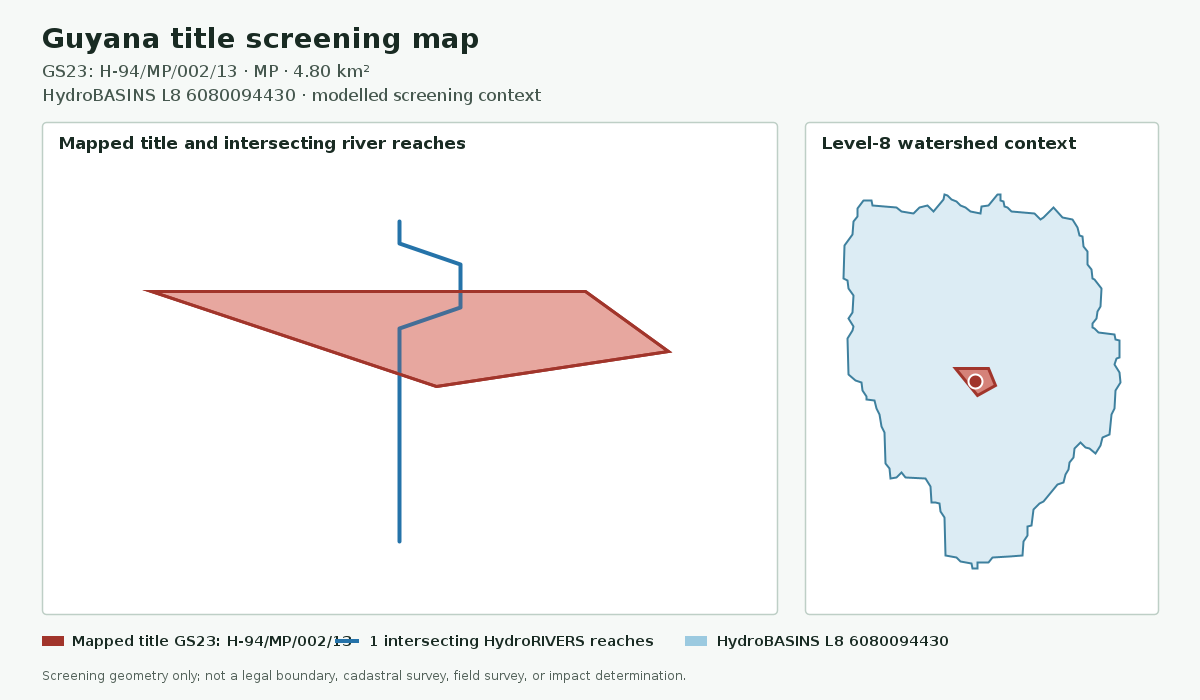
- The stored title polygon intersects 1 modelled HydroRIVERS reaches.
- HydroBASINS levels 8, 7, and 6 provide local, intermediate, and regional drainage context; the local basin is 6080094430.
- Protected-area and forestry geometry is excluded unless its source and layer are explicitly approved for client use.
02 · Mapped evidence
Title, waterways and watershed context
Measured context from approved title and HydroSHEDS layers; unavailable overlays remain explicit.
03 · Claim and citation ledger
Evidence supporting this screen
Material statements are tied to a source or identified as an application-generated calculation.
Title referenceGS23: H-94/MP/002/13
Mapped area4.80 km²
Intersecting reaches1
Local basin6080094430
Spatial useScreening context
Structured title record
Checked 24 Oct 2026, 19:56 UTCModelled river-network screening context
Checked 23 Oct 2026, 19:54 UTCModelled watershed hierarchy
Checked 23 Oct 2026, 19:54 UTC04 · Decision controls
Principal limitations
- HydroRIVERS and HydroBASINS are modelled regional datasets, not field observations.
- Intersection does not establish pollution, impact, non-compliance, or legal restriction.
05 · Next checks
Recommended follow-up
- Confirm current title status and recorded parties with the responsible mining authority.
- Check the generated date, source freshness, citations, and stated missing-data gaps before relying on a finding.
- Use current site-specific surveys, regulatory records, and professional advice for material decisions.