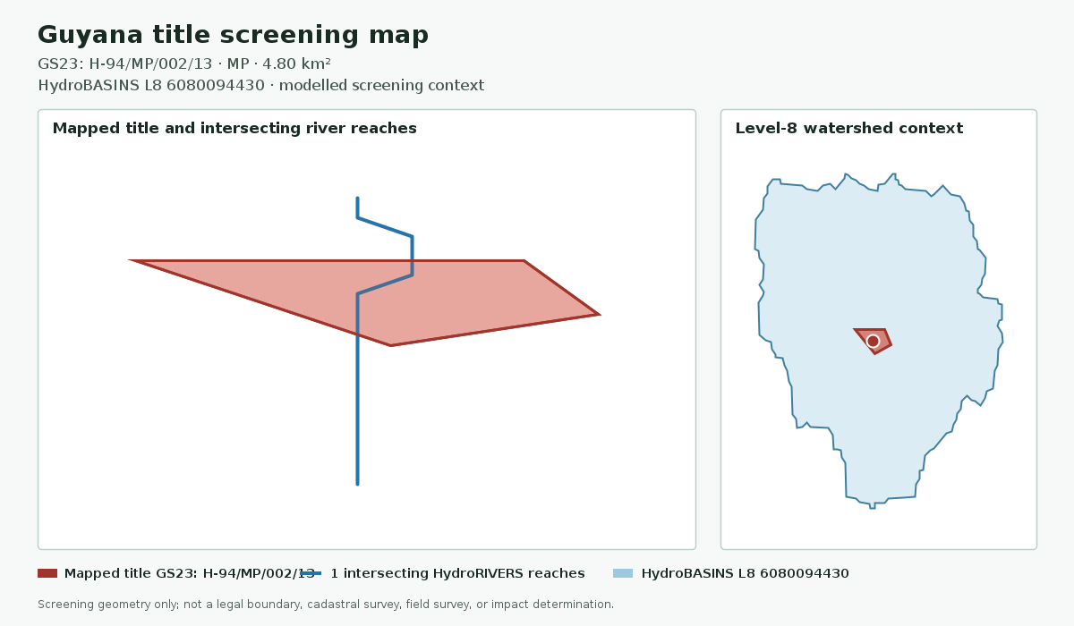
Which approved spatial datasets intersect or contextualise this plot, and which material checks remain unavailable? Turn mapped geometry into a cited screening position before site-specific environmental review.
Screening results indicate proximity or overlap in the loaded datasets. They do not establish environmental harm, compliance, causation or legal restriction.
Spatial screening modelResolve the plot, measure context, expose the gaps
P-27/MP/002 · screening scale
Selected titleP-27/MP/002Mapped geometry
Screening results
Title geometryResolvedSource-linked component
Waterway contextMeasuredHydroRIVERS screening
Watershed hierarchyL8 → L6HydroBASINS context
Protected areas + forestryUnavailableNot presented as zero exposure
Screening positionMeasured hydrology context is available; unavailable overlays and authority checks remain explicit.No harm or compliance conclusionOpen the cited example
Example screening position
Hydrology context is measurable. Protected-area, forestry and site-specific impacts remain unassessed.
Title geometry
Resolved
Measured context
Waterways and watershed hierarchy
Principal gap
Unavailable overlays and field evidence
Included in the area screen
Measured context with visible limits
Plot identity, mapped geometry and area
Approved waterway intersection screening
Local-to-regional watershed context
Relevant cited environmental records
Unavailable overlays and missing-data gaps
Verification actions and report limitations
How the screen is assembled
Plot
Title geometry
Begin with a stored public title polygon and retain its file reference, permit type and source provenance.
Water
River intersections
Identify modelled HydroRIVERS reaches intersecting the selected plot and state the dataset’s screening-scale limits.
Basin
Watershed hierarchy
Resolve HydroBASINS levels 8, 7 and 6 for local, intermediate and regional drainage context.
Evidence
Environmental records
Link relevant EPA notices, assessments, permits or monitoring references where the indexed evidence supports the connection.
Currently supported
Measured hydrology context with visible provenance
Approved HydroRIVERS and HydroBASINS layers can support intersection and basin findings in the Guyana sample workflow. Each result retains its source and modelled-data caveat.
Waterway contextIntersecting modelled reaches
Watershed contextLocal L8 through regional L6
EPA evidenceCited when a relevant indexed record exists
Source freshnessLatest checked or updated date shown
Unavailable analysis
Missing overlays are never presented as zero exposure
Protected-area and forestry geometry remains outside customer calculations until source permission, geometry QA and explicit client-use approval are recorded. Public availability alone is not treated as permission for commercial spatial analysis.
Required verification
Checks outside this report
Confirm current title, permit and environmental-authorisation status with GGMC and EPA Guyana.
Commission site-specific hydrology, biodiversity, land-use and field surveys where material.
Review current project documents, land access, village consent and operating conditions.
Obtain qualified environmental, technical and legal advice before a transaction or operating decision.
Environmental checks during an application
The permit navigator separates the GGMC title route from EPA authorisation, private-land authority and Amerindian village consent.